WildlifeMapper: Aerial Image Analysis for Multi-Species Detection and Identification
Abstract
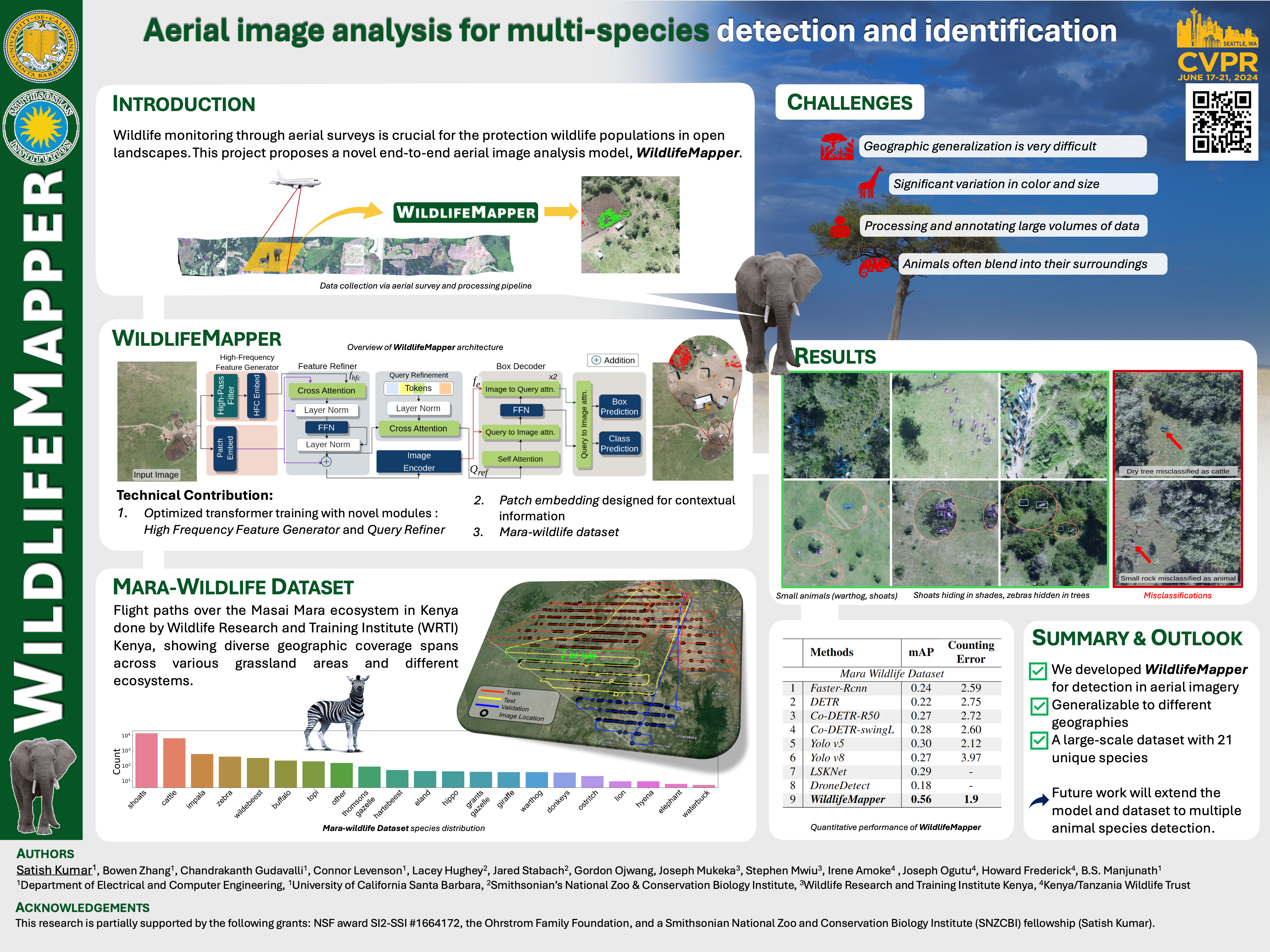
We introduce WildlifeMapper (WM), a flexible model designed to detect, locate, and identify multiple species in aerial imagery. It addresses the limitations of traditional, labor-intensive wildlife population assessments that are central to advancing environmental conservation effortsworldwide. While a number of methods exist to automate this process, they are often limited in their ability to generalize to different species or landscapes due to the dominance of homogeneous backgrounds and/or poorly captured local image structures. WM introduces two novel modules that help to capture the local structure and context of objects of interest to accurately localize and identify them, achieving a state-of-the-art (SOTA) detection rate of 0.56 mAP. Further, we introduce a large aerial imagery dataset with more than 11k Images and 28k annotations verified by trained experts. WM also achieves SOTA performance on 3 other publicly available aerial survey datasets collected across 4 different countries, improving mAP by 42%. Source code and trained models are available at Github.