SegEarth-OV: Towards Training-Free Open-Vocabulary Segmentation for Remote Sensing Images
Abstract
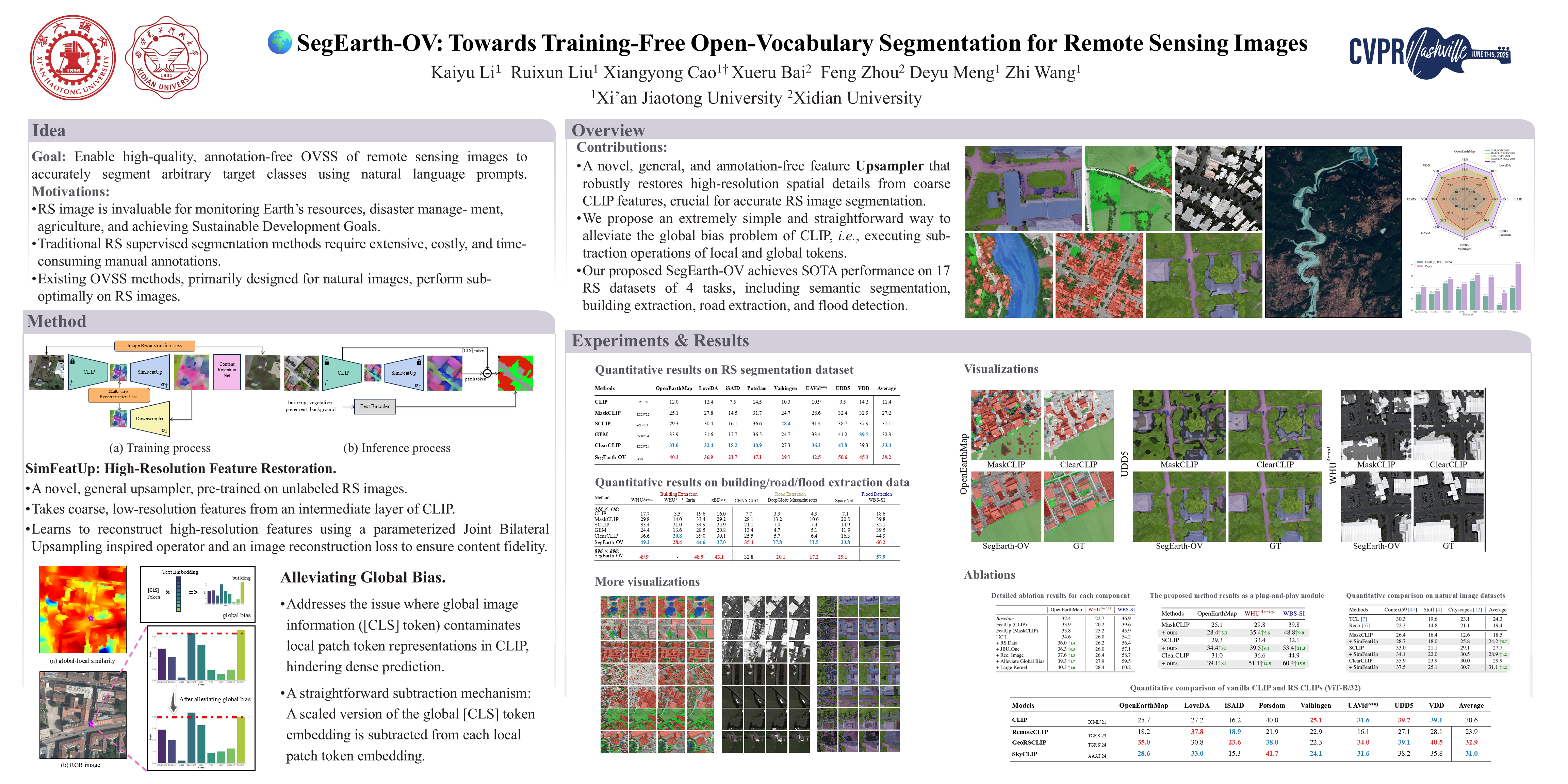
Current remote sensing semantic segmentation methods are mostly built on the close-set assumption, meaning that the model can only recognize pre-defined categories that exist in the training set. However, in practical Earth observation, there are countless unseen categories, and manual annotation is impractical. To address this challenge, we first attempt to introduce training-free open-vocabulary semantic segmentation (OVSS) into the remote sensing context. However, due to the sensitivity of remote sensing images to low-resolution features, distorted target shapes and ill-fitting boundaries are exhibited in the prediction mask. To tackle these issues, we propose a simple and universal upsampler, i.e. SimFeatUp, to restore lost spatial information of deep features. Specifically, SimFeatUp only needs to learn from a few unlabeled images, and can upsample arbitrary remote sensing image features. Furthermore, based on the observation of the abnormal response of patch tokens to the [CLS] token in CLIP, we propose to execute a simple subtraction operation to alleviate the global bias in patch tokens. Extensive experiments are conducted on 17 remote sensing datasets of 4 tasks, including semantic segmentation, building extraction, road detection, and flood detection. Our method achieves an average of 5.8\%, 8.2\%, 4.0\%, and 15.3\% improvement over state-of-the-art methods on the 4 tasks.